
Nigeria, commonly known as the giant of Africa with more than 150 million people is the most populous country in Africa. With one of the biggest democracies in the world and a presidential system of government, it has a dual economy, based on its rich natural resources, traditional agriculture and the trade sector. It not only shows high potential in human resources but also is endowed with rich natural resources such as oil, gas and minerals. The country aims to develop other productive sectors, and boosted by the size of its population and economy, it is a regional powerhouse.
The country has a rich land of diverse cultural heritage, with more than 250 ethnic groups, a wide array of religions and sophisticated visual arts. The talent, and creativity found in its festivals, music, sculptures, literature and films are well-known all over the world.
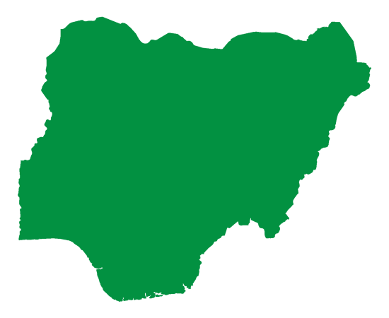
Physical Features and Natural Setting
Nigeria is located at the extreme inner corner of the Gulf of Guinea on the west coast of Africa and lies between latitudes 3°15’ to 13°30’ N and longitudes 2°59’ to 15°00’ E. On the south, it is bordered by the Gulf of Guinea, on the west and north, it is bordered by the Republics of Benin and Niger respectively, and on the east, it adjoins the Cameroon Republic. Nigeria has a land area of 923, 768 km2 in which land comprises 910, 768 km2 and water accounts for 13, 000 km2. Its greatest length from North to South is 1, 046 km, and its maximum breadth from East to West is 1,127 km with a total boundary length of 4,900 km, of which 853 km is coastline. Comparatively, the area occupied by Nigeria is slightly more than twice the size of the state of California in the United States of America and almost twice that of France.
Climate
Rainfall
Nigeria has a tropical climate with variable rainy and dry seasons, depending on location. It is hot and wet most of the year in the southeast but dry in the southwest and farther inland. A savanna climate, with marked wet and dry seasons, prevails in the north and west, while a steppe climate with little precipitation is found in the far north. In general, the length of the rainy season decreases from south to north. In the south, the rainy season lasts from March to November, whereas in the far north, it lasts only from mid-May to September. A marked interruption in the rains occurs during August in the south, resulting in a short dry season often referred to as the “August break.” Precipitation is heavier in the south, especially in the southeast, which receives more than 120 inches (3,000 mm) of rain a year, compared with about 70 inches (1,800 mm) in the southwest. Rainfall decreases progressively away from the coast; the far north receives no more than 20 inches (500 mm) a year.
Temperatures and Humidity
Temperature and humidity remain relatively constant throughout the year in the south, while the seasons vary considerably in the north; during the northern dry season, the daily temperature range becomes great as well. On the coast, the mean monthly maximum temperatures are steady throughout the year, remaining about 90 °F (32 °C) at Lagos and about 91 °F (33 °C) at Port Harcourt; the mean monthly minimum temperatures are approximately 72 °F (22 °C) for Lagos and 68 °F (20 °C) for Port Harcourt. In general, mean maximum temperatures are higher in the north, while mean minimum temperatures are lower. In the northeastern city of Maiduguri, for example, the mean monthly maximum temperature may exceed 100 °F (38 °C) during the hot months of April and May, while in the same season, frosts may occur at night. The humidity generally is high in the north, but it falls during the harmattan (the hot, dry northeast trade wind), which blows for more than three months in the north but rarely for more than two weeks along the coast.
Geological Features
The geology of Nigeria could be described as Pre-Cambrian, Cretaceous, Tertiary, Quaternary and Volcanic. The pre-Cambrian rocks are made up of igneous and metamorphic rocks and cover almost fifty percent of the country. They are crystalline in nature and consist of granite, gneiss and schist and they are commonly referred to as the Basement Complex. When weathered, the older granites give rise to smooth-domed hills known as inselbergs. The Cretaceous rocks are relatively younger rock types than the Pre-Cambrian rock types. They consist of various sandstones that are basically classified as older sedimentary rocks. Cuesta relief forms are characteristic of these rocks; and coal, lignite and limestone are important minerals found in these rocks. These rocks occupy the basins of Niger, Benue, Gongola and Cross Rivers. The younger sedimentary rocks are the rocks of the Tertiary Age consisting mainly of sandstone but with some clay and limestone. They are found in the Chad Basin and in the South with its widest extent in the Lower Niger. The alternating layers of clay and sand, especially in the Chad Basin are a noteworthy characteristic of these rocks. The Quaternary rocks are comparatively recent depositions found along the coast and river deltas of the country. They are made up of sandy and muddy deposits. Volcanic rocks which are of the Tertiary Age are not widespread in Nigeria. They are mainly found in the centre and northeast of the country. The main areas are the Biu and Jos Plateau and the Kerrikerri area of the Benue valley. The acid and basic rocks of these places give rise to peculiar volcanic features.
Relief
The relief of Nigeria consists of plains in the north and south interrupted by plateaux and hills in the centre of the country. The Sokoto Plains lie in the northwestern corner of the country, while the Borno Plains in the northeastern corner extend as far as the Lake Chad basin. The Lake Chad basin and the coastal areas, including the Niger River delta and the western parts of the Sokoto region in the far northwest, are underlain by soft, geologically young sedimentary rocks. Gently undulating plains, which become waterlogged during the rainy season, are found in these areas. The characteristic landforms of the plateaus are high plains with broad, shallow valleys dotted with numerous hills or isolated mountains, called inselbergs; the underlying rocks are crystalline, although sandstones appear in river areas. The Jos Plateau rises almost in the centre of the country; it consists of extensive lava surfaces dotted with numerous extinct volcanoes. Other eroded surfaces, such as the Udi-Nsukka escarpment rise abruptly above the plains at elevations of at least 300 m. The most mountainous area is along the southeastern border with Cameroon, where the Cameroon Highlands rise to the highest points in the country, Chappal Waddi (2,419 m) in the Gotel Mountains and Mount Dimlang (2,042 m) in the Shebshi Mountains.
Drainage
The major drainage areas in Nigeria are the Niger-Benue basin, the Lake Chad basin, and the Gulf of Guinea basin. The Niger River, from which the country’s name was derived, and the Benue, its largest tributary, are the principal rivers. The Niger has many rapids and waterfalls. The Benue is not interrupted by either rapids or waterfalls and is navigable throughout its length, except during the dry season. Rivers draining the area north of the Niger-Benue trough include the Sokoto, the Kaduna, the Gongola, and the rivers draining into Lake Chad. The coastal areas are drained by short rivers that flow into the Gulf of Guinea. River basin development projects have created many large man-made lakes, including Lake Kainji on the Niger and Lake Bakolori on the Rima River. The Niger delta is a vast low-lying region through which the waters of the Niger River drain into the Gulf of Guinea. Characteristic landforms in this region include oxbow lakes, river meander belts (see meander), and prominent levees. Large freshwater swamps give way to brackish mangrove thickets near the seacoast.
Soils
Nigerian soils are usually of poorer quality than those in other regions of the world and the major soil zones conform to geographic location. Loose sandy soils consisting of wind-borne deposits and riverine sands are found in the northern regions, although, in areas where there is a marked dry season, a dense surface layer of laterite develops, making these soils difficult to cultivate. The soils in the northern states of Kano and Sokoto, however, are not subject to leaching and are therefore easily farmed. South of Kano the mixed soils contain locally derived granite and loess (wind-borne deposits). The middle two-thirds of the country, the savanna regions, contain reddish, laterite soils; they are somewhat less fertile than those of the north because they are not subject to as much seasonal drying, nor do they receive the greater rainfall that occurs in the more southerly regions. The forest soils represent the third zone. There the vegetation provides humus and protects it from erosion by heavy rainfall. Although these soils can readily be leached and lose their fertility, they are the most productive agriculturally. Hydromorphic and organic soils, confined largely to areas underlain by sedimentary rocks along the coast and river floodplains, are the youngest soil types.
Flora and Fauna
Flora
In Nigeria, vegetation closely follows the pattern of rainfall. The main vegetation patterns run in broad east-west belts, parallel to the Equator. Forests and grasslands are the major vegetation types. Forests are found to the south where rainfall is high and along river courses in the north – called gallery forests. Three major types of forests are recognisable. The mangrove swamp forest is found within the Niger Delta and in the Cross River Delta. The mangrove forests of Nigeria are the most extensive forests of this type in the world. The environment of this forest is brackish while the most common tree is the red mangrove which grows to a height of about 20 m. Immediately after the mangrove swamp forest the ground rises slightly and is clothed with freshwater swamp forest. Moisture-loving plants and various palms, yielding piassava fibre and materials for thatching flourish here. A short way inland, the freshwater swamp forest gives way to dense tropical rainforests. Economically valuable, the oil palm grows wild and is usually preserved when the forest is cleared for cultivation. In the more densely populated parts of the southeast, the original forest vegetation has been replaced by open palm bush. In the southwest large areas of forest have been replaced by cacao and rubber plantations.
Towards the north, as rainfall decreases and the dry season lengthens, the rainforests pass gradually into tropical grassland known as savannas. Tropical grassland occupies the area north of the forest belt and extends over almost three-fifths of the country. The characteristic vegetation of the savannas consists of grassland with scattered trees of no great height either growing singly or in groups and sometimes occurring as woodlands. The area is studded with baobab, tamarind, and locust bean trees. Like its forest counterpart, the savanna could be broadly divided into three from south to north: Guinea, Sudan and Sahel.
The Guinea Savanna has the greatest amount of rainfall among the savanna types and a shorter dry period. Consequently, it has more trees than other types. The grass here is rather coarse. It occupies half of the country coinciding roughly with the middle belt. It can be referred to as a transitional climate and vegetation between the north and the south because it stands as a zone of mixed culture in which food crops of the south are cultivated side by side with those of the far north. In Sudan Savanna annual rainfall averages about 560- 1020 mm. Most trees in the Sudan Savanna have small leaves to prevent excessive transpiration, though there are few broad-leaved ones. As one proceeds northward through the zone it gives way to trees and thorns.
The Sahel Savanna occurs in the extreme northeast of Nigeria, and it has at least eight dry months. This zone is characterised with light foliage and thorns. Grasses are short, discontinuous, wiry and tussock. They are much used by cattle and sheep. There is no real gallery or fringing forests but only riparian woodland of certain acacias. Semi-desert conditions exist in the Lake Chad region, where various species of acacia and the doum species of palm are common. In the far northern areas, the nearly total disappearance of plant life has facilitated a gradual southward advance of the Sahara.
Fauna
Camels, antelopes, hyenas, lions, baboons, and giraffes once inhabited the entire savanna region, and red river hogs, forest elephants, and chimpanzees lived in the rainforest belt. Animals found in both the forest and savanna included leopards, golden cats, monkeys, gorillas, and wild pigs. Today these animals can be found only in such protected places as the Yankari National Park in Bauchi State, Gashaka Gumti National Park in Taraba State, Kainji Lake National Park in Niger State (see Kainji Lake), and Cross River National Park in Cross River State. Rodents such as squirrels, porcupines, and cane rats constitute the largest family of mammals. The northern savanna abounds in guinea fowl. Other common birds include quail, vultures, kites, bustards, and grey parrots. The rivers contain crocodiles, hippopotamuses, and a great variety of fishes.